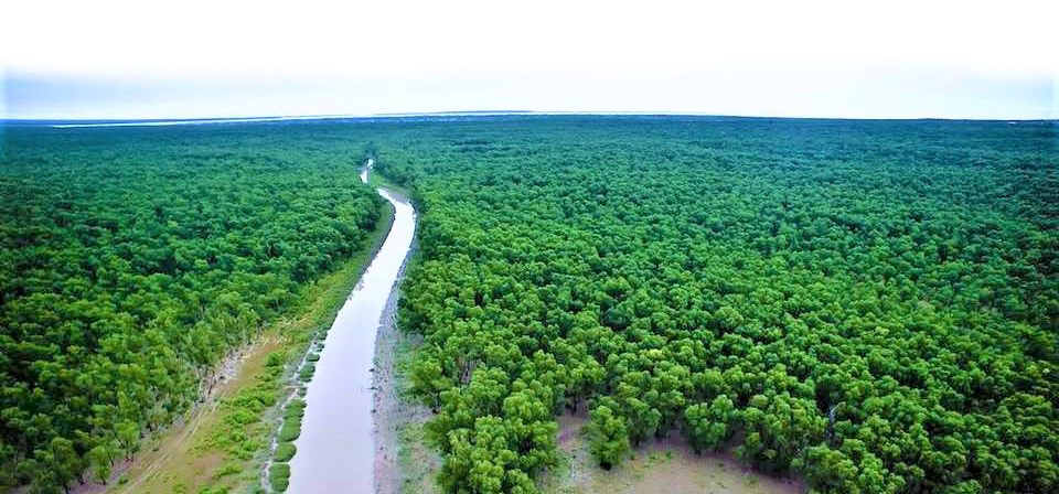
Nijhum Dwip is (literally “the island of silence”) is an accreted island in the central coastal zone of Bangladesh under Hatiya Upazila of Noakhali District. It is a cluster of several small accreditations mainly Char Osman, Char Kamla, Char Muri and Ballar Char. A virgin island with intertidal mudflats and sand-flats has a scenic treasure trove having 20 kms long sandy and grassy beach. Total area of the island is about 40390 ha. The forest area is about 9000 acres and is very dense with many species. The forest bed is muddy and inundated by tidal actions twice in a day. Vibrant biodiversity allowed Nijhum Dwip to be listed as a wetland of international importance under the Bangladesh Wildlife (Preservation) Order 1973, and it was made a National Park of Bangladesh in 2001.
1.2. Historical Background
Fishermen of the nearby Hatiya Island started to use Nijhum Dwip during the 1940s as temporary homes during fishing season (personal communication with union parishad member). In the 1950s fishermen named it Ichamoti dwip (meaning mine of prawn; locals referred to island as icha mach, or prawn) due to a high abundance of prawn available in the waters surrounding the island (Amin, 2001). Temporary settlers later renamed it Baollar char (meaning accreted sand) , due to its high protuberance of sand. A land survey of Nijhum Dwip was conducted during 1959-1960, and after that, some of the fisherfolk came to live permanently on the island. However, Bangladesh’s most devastating cyclone of 12 November 1970, which killed about half a million coastal people in Bangladesh, killed all of the 300 households (1200 to 1500 people) settled on this exposed island. In an official visit to the island in 1973, government officials, politicians and social elites gave the island an official name in recognition of its natural beauty, Nijhum Dwip. In 2008, the government of Bangladesh declared Nijhum Dwip and the Char Bahauddin as a Union Parishad of Hatiya Upazila.
1.3. Location
Nijhum Dwip is situated between latitude 22º1´ and 22º6´N and longitude 90º58´ and 91º3´E. Nijhum Dwip is separated from Hatiya by the Moktaria Channel, which is about 700-1200m wide: the island area is only 10 km2 in area.
1.4. Population and Livelihood
The population has since increased to about 4500 households with an estimated 30,000 people living in different cluster villages. The literacy rate on the island is very low, at about 10%. Children below the age of 12 years account for 30% of the total population and married adults represent about 40%. The lack of sanitation facilities on the island causes severe problems because none of the households use sanitary latrines. Drinking water is available from shallow tube wells, which households share at a rate of one well per 50-75 households.
1.5. Geomorphology
The island is about 4‐5 meters high from the sea level.
Climate
The area enjoys a moist tropical maritime climate and rainfall is frequent and heavy during the monsoon season (May to October) ranging between 140 mm to1040 mm. Temperature ranges from 16ºC to 33ºC, whereas humidity ranges from 29% to 99% (BBS 2011).
Temperature
Nijhum Dwip is typically tropical with average annual maximum and minimum temperatures of 30°C and 21.6°C respectively (BMD 2009). Changes in temperature, even small changes in water temperature, are expected to exert strong pressure upon fish ecology (WWF 2005).
Rainfall
The southwest monsoon brings much rainfall from May to September while the northeast monsoon brings some rain in October and November. About 80-90% of annual rainfall is confined to the monsoon months (April-October). Annual mean total rainfall has decreased from 3561mm in 1988 to 3531mm in 2008. Old fishermen have reported noticeable climate pattern changes include increasing variability in the dates of onset and end of the rainy season, changes in wind direction, tidal magnitude, rainfall distribution pattern throughout the season, and an increase in thunderstorm activity.
Biodiversity Status
The environment surrounding the island is a unique assemblage of marine, brackish and fresh water ecosystem with estuarine characteristics. This combination has endowed Nijhum Dwip with a highly productive ecosystem for fisheries resources.
Flora:
Mangrove plantation started in 1973 with Sonneratia apetala (keora) (80%) and Avicennia officinalis(baine) (15%) that covered the northwest part of the island. The Keora (or Kerfa) tree was chosen for its fast growing root system, which anchors itself into the sandy ground. The ecosystem is biologically diverse with 68 plant and 66 animal species (Rosario, 1997).
A recent study reveals, a total of 152 plant species under 56 families has been recorded from Nijhum Dweep. Among the species, 66 are represented by to trees, 15 by shrubs, 58 by herbs and 13 by climbers. Within recorded plants, 68% found to be medicinal and 32% used for other purposes (Fig. 3). Dolichandrone spathacea, a threatened plant species of Bangladesh was recorded from the mangrove forest (Ara et al. 2013).
In the inundated area of tidal action, the forest has been formed by mangrove vegetation. Among the vegetation:
i) The most common tree species in the top canopy is Sonneratia apetala (Keora). Associate species in this canopy is Avicennia officinalis (Baine).
ii) The middle canopy mainly dominated by only Excoecaria agallocha (Geoa). Two rare tree species also recorded in this layer of vegetation. These are Bruguiera gymnorrhiza (Kakra) and Dolichandrone spathacea.
iii) The ground primarily covered by Zoysia matrella, Porteresia coarchtata, Fimbristylis acuminata and Fimbristylis ferruginea.
Fauna
To further enhance the biodiversity of the island, three pairs of spotted deer (Axis axis) were released in the island in 1980 which increased to 14,400 (Iftekhar and Takama 2008). Subsequent introductions have included several pairs of monkeys (Macaca mulatta), snakes (Python molurus) and Leopard cat (Felis bengalensis).
It is an important fish breeding ground and wildlife habitat.
To further enhance the biodiversity three pairs of spotted deer (Axis axis) were released on the island in 1980. The number of deer has increased to 14,400 at present (BFD 2006).
Some of the common reptiles include Calotes versicolor, Mabuiya sp, Varanus bengalensis, V. flavescens, Xenochrophis piscator, Naja naja and Lessimys punctata. Enhydrina schistosa is commonly reported by fishermen in the waters around Nijhum Dwip.
The Ganges River Dolphin Platanisia gangetica is reported to be common. Other common mammals include Canis aureus, Herpestes auropunctatus, Aonyx cinerea, Viverra zibetha and Bandicota indica. (Rashid et al., 1987)
Migratory Birds
The island is at the crossroads of two international flyways viz. the East-Asia Australasian flyways and Central Asian flyways and is the southern-most staging ground of around 60 species of migratory birds. The mudflat of Nijhum Dwip is an important wetland site for wintering migratory as well as resident birds including several globally threatend species like:
the Indian Skimmer (Rynchops albicollis),
Spoon-billed Sandpiper (Eurynorhynchus pygmeus),
Nordmann’s Greenshank (Tringa guttifer) and
Asian Dowitcher (Limnodromus semipalmatus) by providing them with their wintering ground (PDO-ICZMP 2004).
Macro-benthos
Macro-benthos are an important and integral frequently subjected to tropical cycles, erosion and component of all aquatic ecosystems which lives on, in or strong wave action. near the bottom of water bodies [1] Benthic organisms Although globally macrobenthos have been much serve as direct food for other higher trophic organisms studied but in Bangladesh the published information on (fin and shell fishes) and act as ecological engineer macrobenthos of coastal area is scanty. Sharif [7] and recycling the organic matter and other debris. Polychaetea, oligochaetea, shrimp larvae and crab contributed 85.24 % of total population. Polychaete was dominant by contributing 45.03 % of total macrobenthos.
Introduction
Vulnerability to Natural Hazards
Nijhu Dwip is (literally “the island of silence”) is an accreted island in the central coastal zone of Bangladesh under Hatiya Upazila of Noakhali District. Hatiya Island is surrounded by the South Hatiya channel, West Hatiya channel and East Shahbazpur Channel. East Shahbazpur is a flood channel and the south-west Hatiya is an ebb channel. Hatiya is the famous “pathway” of cyclones in Bangladesh. The ground level in Hatiya is 10 m above the mean sea level; therefore the coastal community has been hampered by seasonal tidal inundation and subsequent salinity intrusions, especially in the dry season when the flow of river water diminishes (Islam, 2008). The residents are extremely vulnerable to future sea level rise.
It may be noted that, there are more than 2,000 cyclone shelters along the coast of Bangladesh, but these can only accommodate one-fourth of the population in highrisk areas (Hasan, 2004). A similar situation also exists in Hatiya. According to union disaster management plans of two of the most cyclone-prone unions in Hatiya, namely the Jajajmara Union and Nijhum Dwip union, the total capacity of cyclone shelters was about 10,000 and 5,000 persons, respectively, whereas the total population of both of the unions was more than 90,000 (Field survey, 2011).
Online Test
-
MCQ Test on Nijhum Dwip
Click Here
Enroll the course

Elsie Cunningham

Maria Luna
Reviews
Provide Your Rating
Quality
Outstanding
Puncuality
Outstanding
Quality
Outstanding
Your Feedback
Elsie Cunningham
Lorem ipsum dolor sit amet, consectetur adipisicing elit, sed do eiusmod tempor incididunt ut labore et dolore.
Maria Luna
Lorem ipsum dolor sit amet, consectetur adipisicing elit, sed do eiusmod tempor incididunt ut labore et dolore.
Emilly Blunt
Lorem ipsum dolor sit amet, consectetur adipisicing elit, sed do eiusmod tempor incididunt ut labore et dolore.